ADVERTISEMENT
Experience the Industrial Past Through the Rosedale Railway Walk
Begin your Rosedale Railway walk at the Lion Inn on Blakey Ridge, set in the North York Moors. After leaving the car park, cross the road and head briefly north. You will soon notice a signpost marked ‘Rosedale Railway North’. Leave the main road here and make your way down to join the historical trackbed of the Rosedale Railway. Turning left, continue north along the valley’s western side. This early section offers a gentle start, with the pathway meandering around the valley head before curving southwards along the eastern flank.
Moving forward, the route takes you beneath the towering Nab Scar escarpment. Not far beyond, you have the option to veer off towards Dale Head Farm, where a charming café provides a quaint pit stop. Opting for this diversion means you’ll need to tackle the climb back to the main path afterwards. The journey southward then reveals the Rosedale East Mines, distinguished by their remarkable Iron Kilns, with the Stone Kilns appearing shortly thereafter.
ADVERTISEMENT
Further on, the path meets a track leading down to a minor road close to Hill Cottages. Continue directly ahead. The following footpath, traversing fields to Low Thorgill Farm, may prove somewhat muddy. Pass through the farm to emerge on Daleside Road. Turning right, the route takes you through Thorgill and on a north-westward bearing. After passing High Thorgill Farm, a left departure from the road introduces you to Medd’s Farm, setting the stage for a challenging uphill trek.
The ascent begins beside a dry stone wall, progressing through a gate and onward across the heathery moorland, showcasing the moors’ wild beauty. Eventually, you’ll reach the railway track once more at Sheriff’s Pit. A right turn here leads you north for approximately 2½ miles, affording expansive views of Rosedale as you approach the end of your Rosedale Railway walk. Crossing through large iron gates, you’ll find the Lion Inn sign, marking the way uphill back to the start.
This less than 9-mile circuit offers a comprehensive clockwise tour around Rosedale, closely following the old railway line’s course. For those intrigued by the full spectrum of the area’s railway history, an alternative 12-mile anticlockwise route is detailed on my website at https://www.paulbeal.com/rosedale-abbey-railway-walk. This guide covers the entire railway, featuring the kilns at Bank Top and a visit to Rosedale Abbey village.
Rosedale Railway Walk: Maps and Tools
Visit either the OS Maps website or the Outdooractive website to view this walking route in greater detail. Both platforms offer a range of features, including the ability to print the route, download it to your device, and export the route as a GPX file. You can also watch a 3D fly-over and share the route on social media.
Rosedale Railway Walk: Distance, Duration, Statistics
Distance: 8¾ miles
Distance: 14 kilometres
Duration: 4 hours
Ascent: 910 feet
Ascent: 277 metres
Type: Circular walk
About the Rosedale Railway
Victorian Engineering Triumph
Constructed in the 1860s, the Rosedale Railway stands as a testament to Victorian engineering prowess, skillfully navigating through the harsh moorlands. The emergence of valuable ironstone in Rosedale necessitated a reliable means of transport to the smelters in County Durham and Teesside. In response, 1861 saw the establishment of a railway stretching 12 miles to Bank Top’s kilns, with an additional 5-mile loop to the East Kilns completed by 1865. The railway, initiating from Blakey Junction, coursed over the moors before descending the steep Ingleby Incline to join the main network at Battersby Junction. This ambitious venture, emblematic of the Victorian age’s innovative spirit and profit-driven motives, played a crucial role in fuelling the Industrial Revolution, with the ironstone it carried being pivotal to the period’s technological advancements.
The Evolution and Demise of Rosedale’s Railway Community
The railway’s establishment catalysed the development of essential infrastructure including sidings, warehouses, and residential cottages, inhabited by a dedicated workforce. These communities braved severe isolation and challenging conditions to ensure the railway’s operational success. The line’s functionality was severely compromised by the 1915-1916 winter, causing a blockade lasting five weeks and significantly reducing workers’ incomes. The post-war decline in ironstone demand led to the railway’s shutdown in 1929, with subsequent dismantling of its infrastructure for reuse. Today, only the winding path of the Rosedale Railway remains, serving as a solemn tribute to its once-critical contribution to the Victorian industrial landscape.
The Monumental Effort of the Navvies
The establishment of the Rosedale Railway was a monumental endeavour, primarily shouldered by navvies – the itinerant workforce integral to Victorian infrastructure projects. The construction of the line to Bank Top, executed with rudimentary equipment over 15 months, and the later addition of the loop to the East Kilns, required significant manual labour to overcome natural obstacles through embankments, cuttings, and inclines. These labourers, housed in temporary barracks, left a minimal trace of their presence, save for the enduring railway infrastructure that stands as a testament to their toil. Regarded by contemporary society with a mix of fear and disdain, their lives were marked by hardship and societal marginalisation.
Exploring the Historic Rosedale Railway Walk
The Rosedale Railway walk presents a unique opportunity to delve into a significant chapter of industrial history. Walking the path of the old railway offers more than scenic beauty; it’s a journey through time, revealing the ingenuity and determination that marked the era of industrial progress.
For a more in-depth exploration of the Rosedale Railway and its history, I have written a detailed article, which you can find here: https://www.paulbeal.com/rosedale-railway. This piece dives deeper into the railway’s construction, operation, and eventual decline, offering a comprehensive look at its legacy in the North York Moors.
Recommended Ordnance Survey Map
The best map to use on this walk is the Ordnance Survey map of the North York Moors Western Area, reference OS Explorer OL26, scale 1:25,000. It clearly displays footpaths, rights of way, open access land and vegetation on the ground, making it ideal for walking, running and hiking. The map can be purchased from Amazon in either a standard, paper version or a weatherproof, laminated version, as shown below.
North York Moors Walking Guidebooks
The North York Moors, by Paddy Dillon, describes 50 walks of 4 to 14 miles across the Tabular Hills, Hambleton Hills, Cleveland Hills, high moors and Cleveland coast, plus the Lyke Wake Walk in four stages, with Ordnance Survey mapping and notes on transport and refreshments.
North York Moors Short Walks Made Easy, published by Ordnance Survey, brings together 10 accessible routes of 2.5 to 4.5 miles, each taking around a couple of hours, ideal for families or anyone short on time. Both books can be purchased from Amazon, as shown below.
Walking the North York Moors
The North York Moors, by Paddy Dillon, a Cicerone guidebook of 50 walks throughout the National Park
Rosedale Railway Walk: My Photos
The view north towards the head of the Rosedale valley, at the beginning of the Rosedale Railway walk, emerges shortly after descending from the Lion Inn on Blakey Ridge. The moorland, a part of the Spaunton Estate, is privately owned and managed. It is internationally recognised for its importance to ground-nesting birds such as curlews and plovers. Gamekeepers manage the heather habitat, controlling predators to enhance the survival chances of other moorland birds and animals.
ADVERTISEMENT
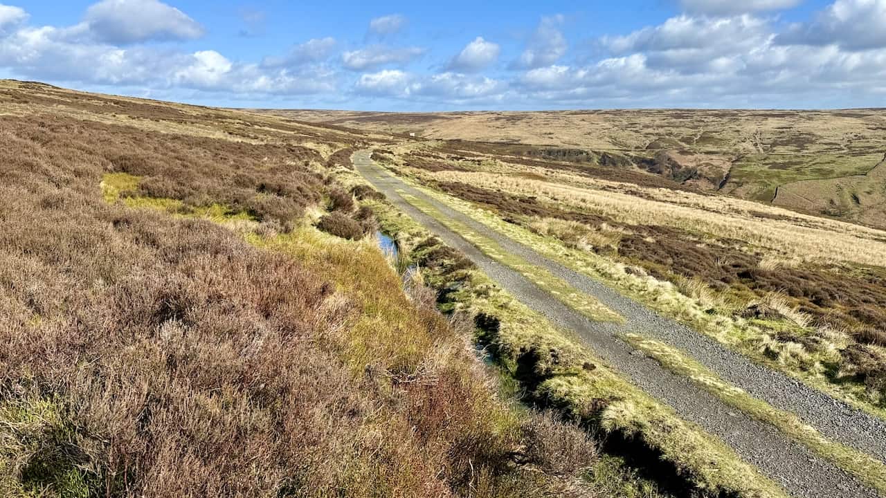
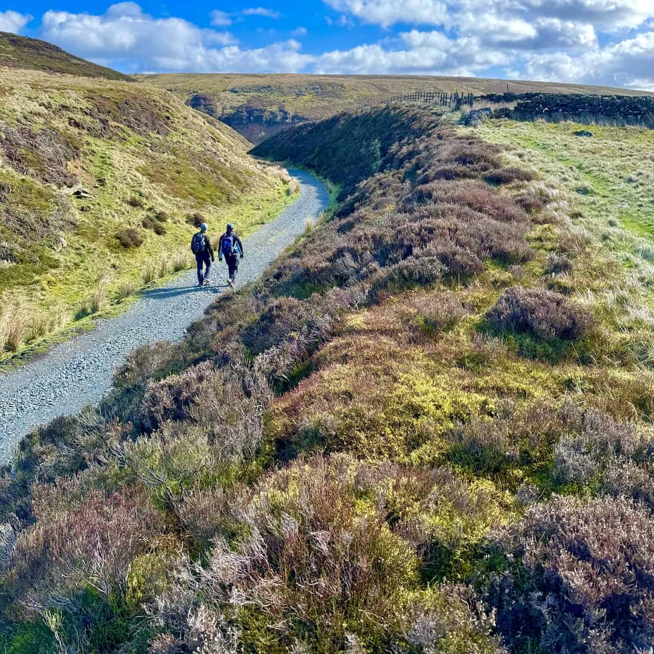
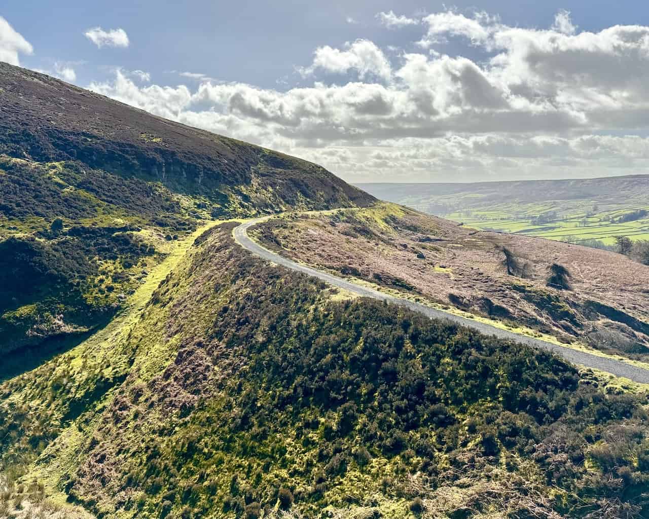
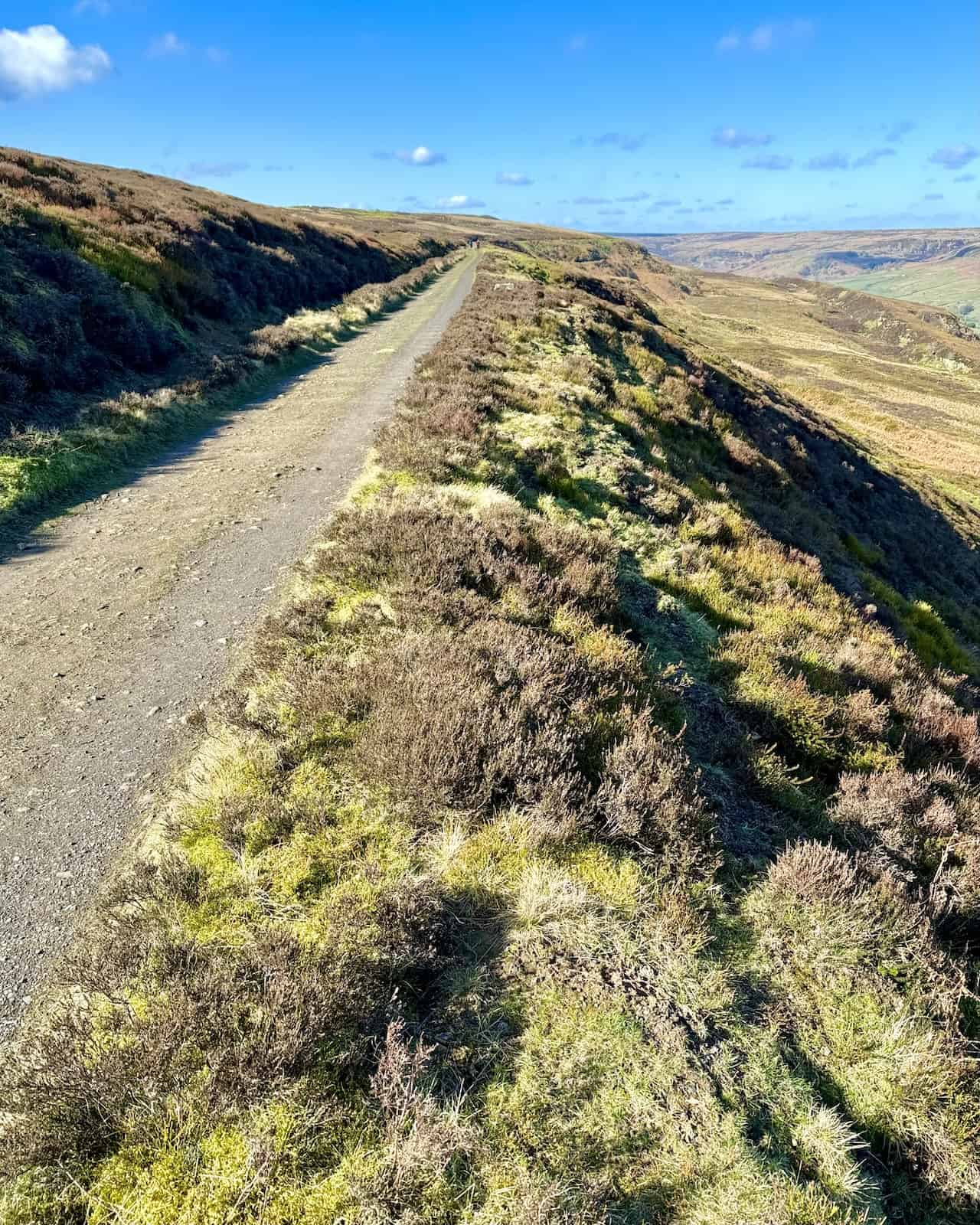
The trackbed of the Rosedale Railway, heading north, circles the upper rim of the Rosedale valley on its western, northern, and eastern sides. The route is straightforward to follow around the valley. Historically, the railway served to transport iron ore from mines and kilns located on both sides of the valley.
ADVERTISEMENT
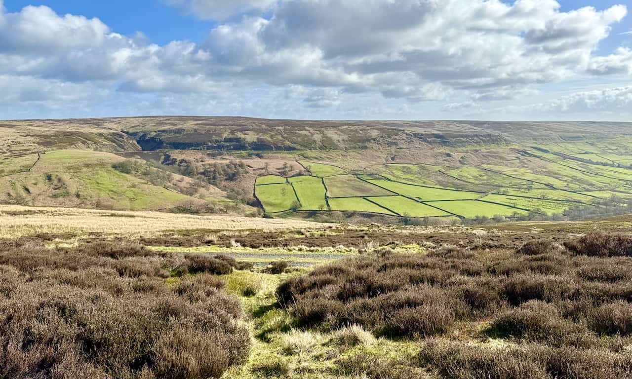
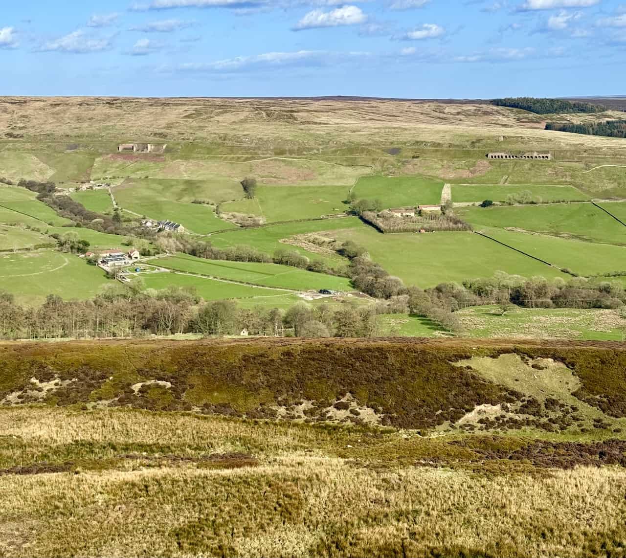
The view east across the valley highlights where the course of the old railway line can be clearly seen. Below the railway line lies a patchwork of green farmers’ fields, and above, the heather-covered moorland dominates.
ADVERTISEMENT
Heading north along the trackbed, the remains of a water tower sit beside the track. This tower supplied water to top up the steam engines that laboured up the incline to Blakey Junction, just south of the Lion Inn.
ADVERTISEMENT
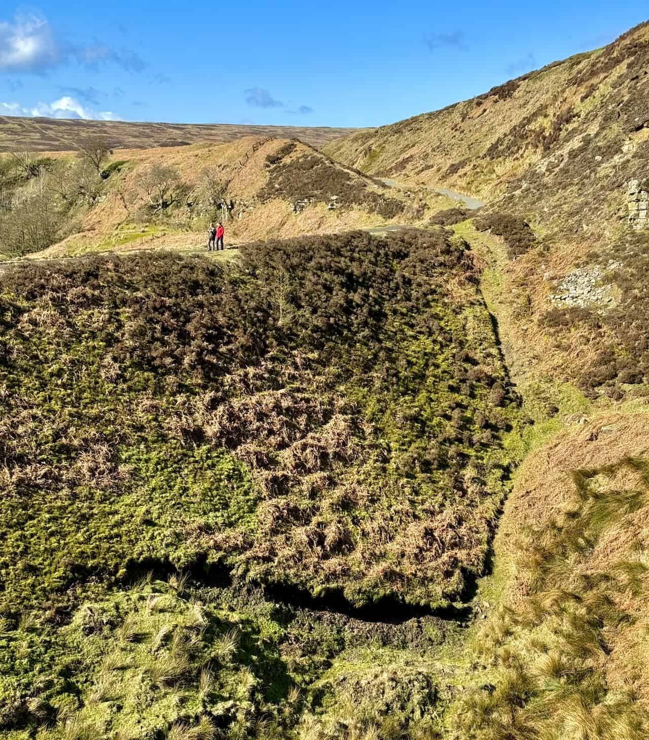
The trackbed skirts around the northern tip of the valley before making a U-turn back along the eastern side. Both the landowners and the National Park Authority maintain the trackbed, ensuring access for estate management and the public.
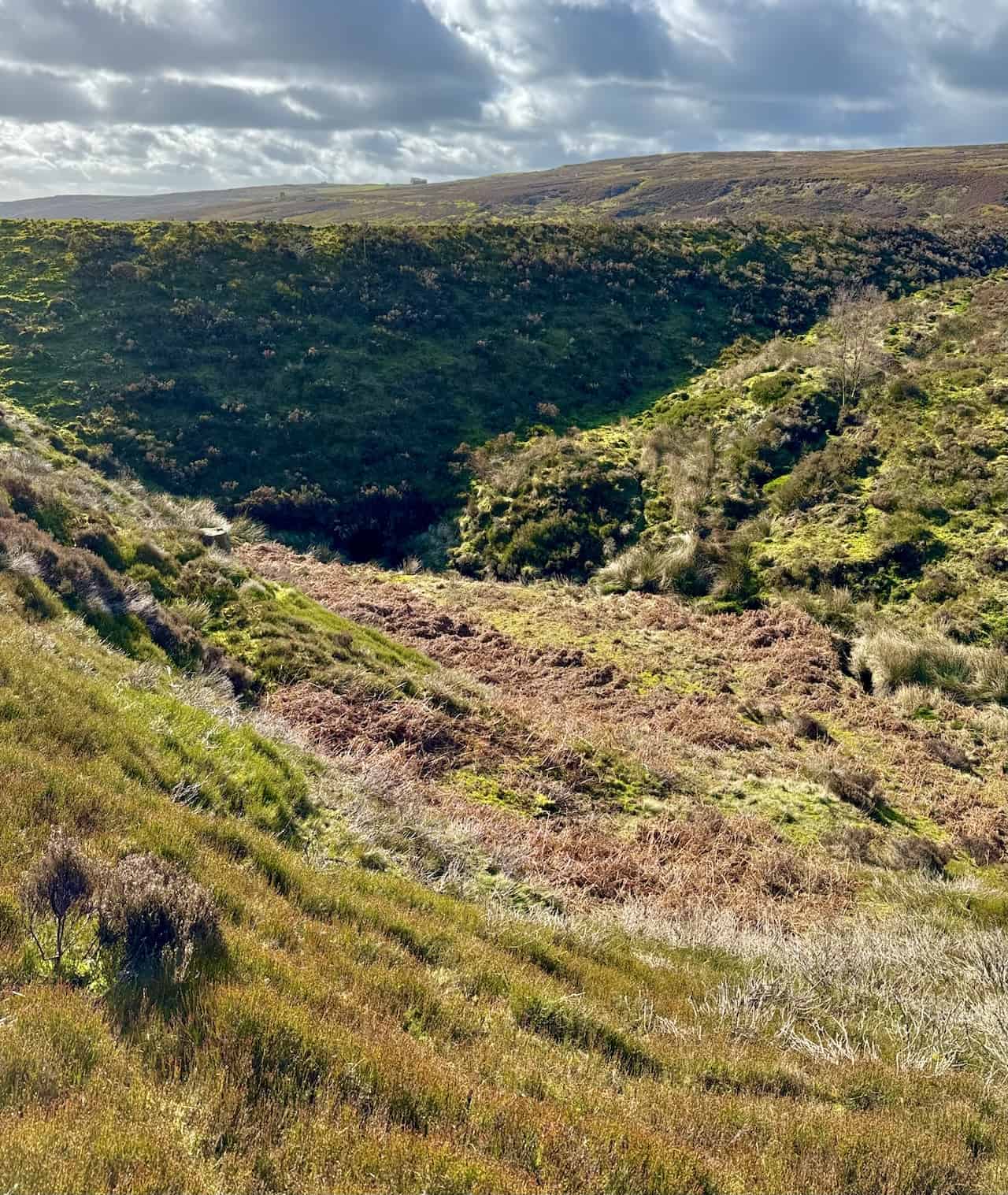
Among the features are several large embankments constructed to carry the railway line across the various ravines. One such embankment, at the railway’s extreme northern tip, allows a stream flowing from the north to pass beneath via an arched stone tunnel. This prevents the ravine from becoming a reservoir, with the embankment acting as a dam.
ADVERTISEMENT
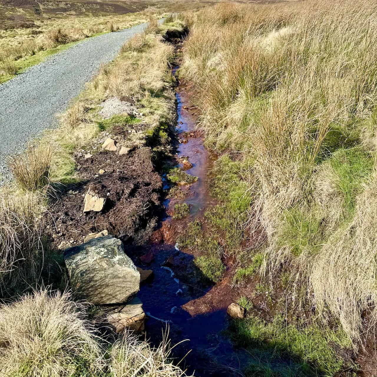
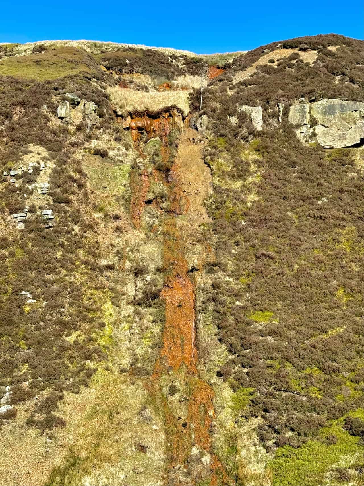
The orange-coloured water and soil in the area largely result from the region’s rich geology and industrial history. This colouration is primarily due to the presence of iron minerals. The decomposition of ironstone, a sedimentary rock rich in iron, releases iron into the surrounding environment. When iron encounters oxygen and water—a process known as oxidation—it forms iron oxides, which exhibit vibrant orange or rust colours, akin to the rusting process in iron metals when exposed to air and moisture.
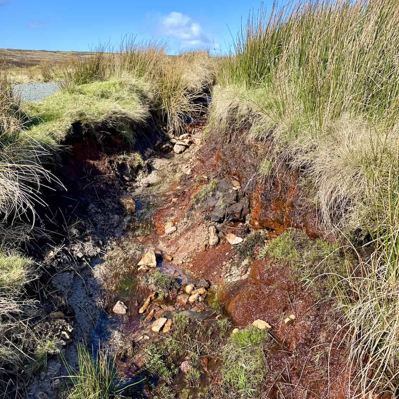
The orange-coloured water in streams, rivers, and standing bodies of water in the North York Moors is often a consequence of iron-rich groundwater seeping into these water bodies. As the iron dissolves and then oxidises, it imparts a striking orange or reddish hue to the water, especially notable in areas of past mining activities that have exposed ironstone to the elements. However, natural processes also contribute to this effect.
ADVERTISEMENT
As for the soil, the presence of iron oxides influences not only its colour but also its composition and health. In the North York Moors, high concentrations of iron oxides in the soil can result in distinct orange colouration. While iron is essential for plant growth, excessive amounts can be detrimental, affecting soil pH and nutrient availability. The region’s long history of industrial activity, particularly ironstone mining which peaked in the 19th and early 20th centuries, has significantly impacted the landscape, altering water and soil chemistry through the exposure of ironstone and other minerals.
The Rosedale Railway was constructed by navvies, the labourers who formed the backbone of Victorian engineering projects. The section leading to the East Kilns in Rosedale required the creation of high embankments, cuttings, and inclines, all built by the navvies using picks, shovels, and wheelbarrows.
These labourers resided in communal turf huts alongside the railway line. Upon completion of their work, they moved on, leaving the huts to decay over time. Life for the navvies was brutal; during the Victorian era, they were often viewed as dangerous, violent, and immoral.
ADVERTISEMENT
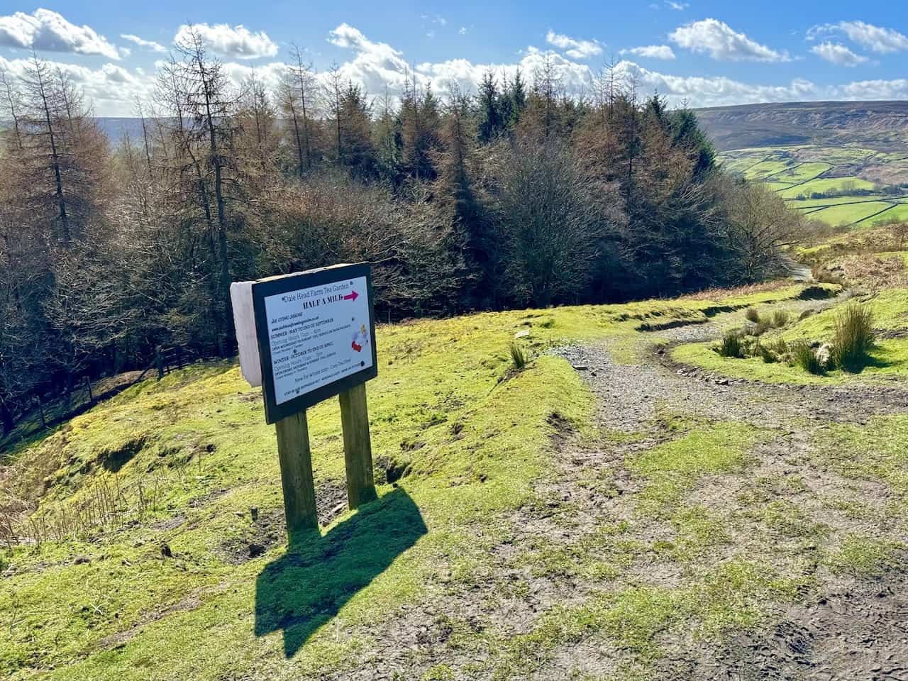
A footpath leading from the Rosedale Railway walk trackbed on the eastern side of the valley near Nab Scar offers access to various parts of the Rosedale valley, including Dale Head Farm. Here, visitors can enjoy the café and avail themselves of teas, coffees, cakes, and other refreshments.
ADVERTISEMENT
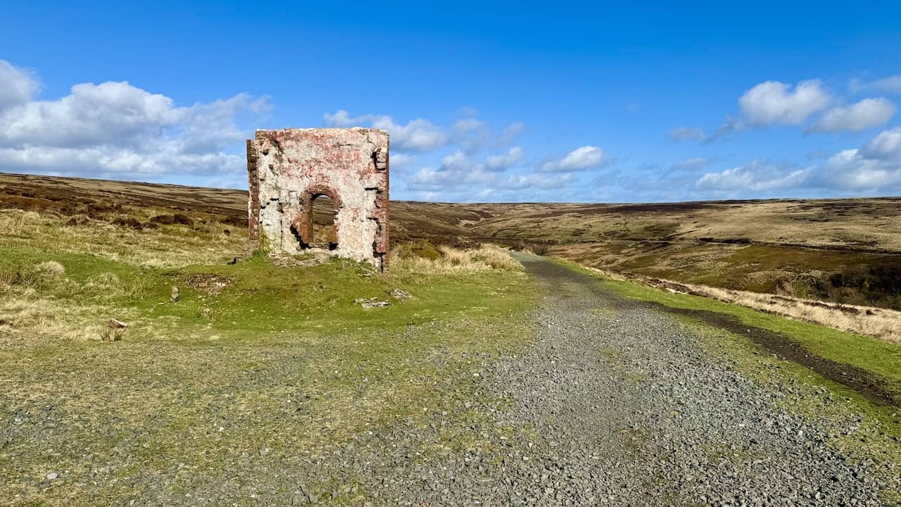
From a slightly elevated position beside the track, one gains a splendid view of the railway line as it circles the rim of the valley, passing the Iron Kilns and moving on to the Stone Kilns. Above the Iron Kilns, the remains of cottages and workshops where the miners and railway workers resided are visible. The upper level of the hill was used for tipping the ironstone into the kilns from above.
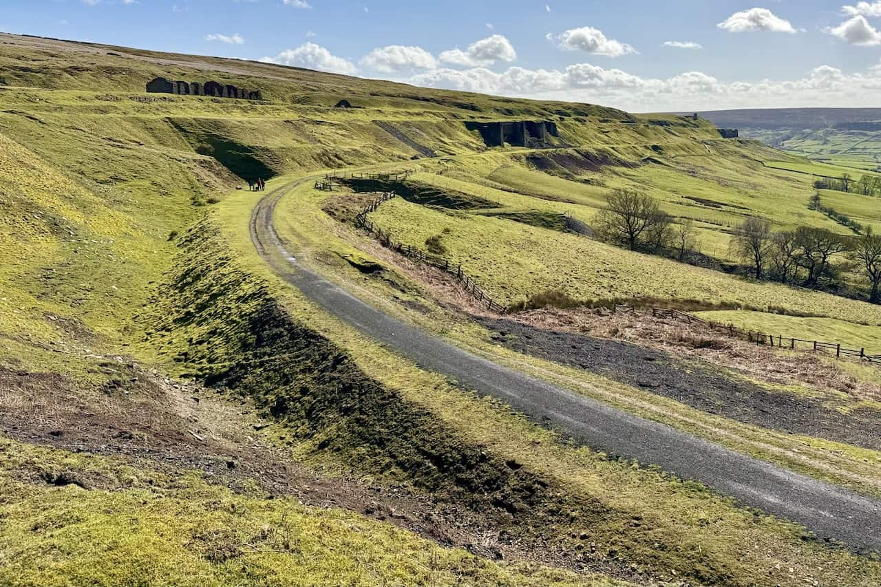
The remains of ‘Black Houses’ cottages near the Iron Kilns are observed. These cottages acquired their name from being formerly painted with weatherproofing black tar.
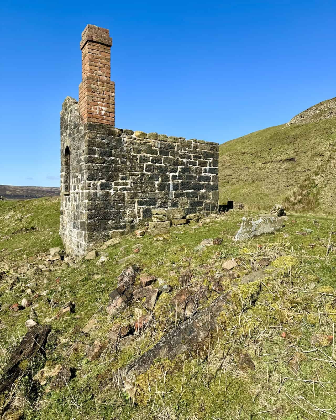
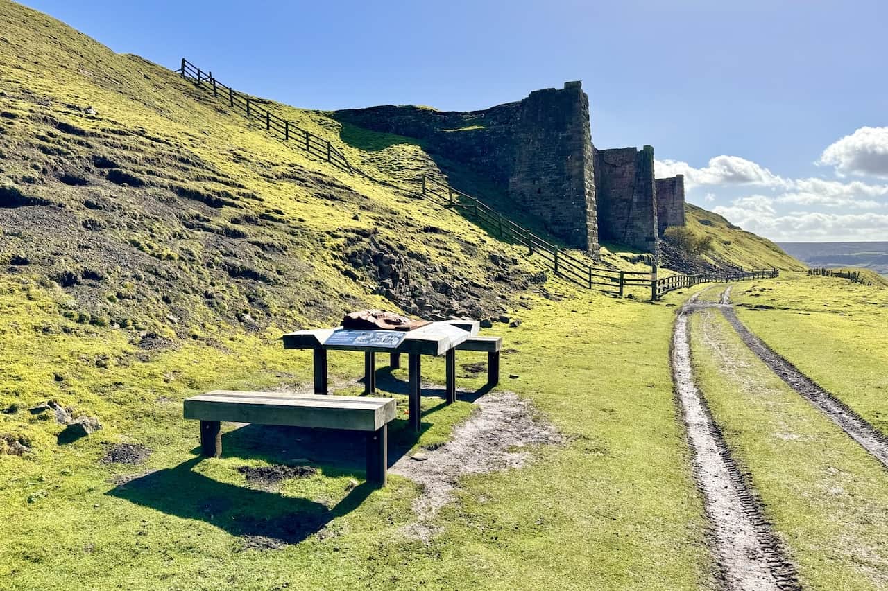
Approaching the Iron Kilns, there is an informative and convenient point, complemented by benches. These serve as an ideal spot for a break during your Rosedale Railway walk, allowing for a coffee and a bite to eat.
ADVERTISEMENT
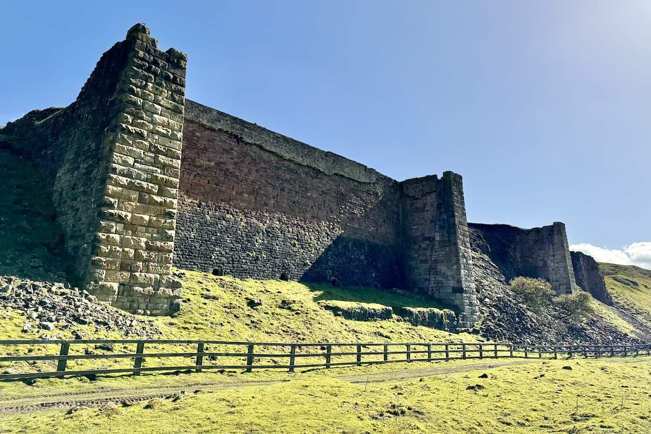
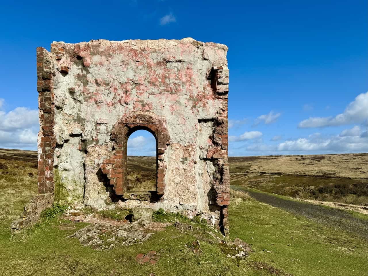
The Iron Kilns stand as giants within the landscape. Originally, these three ironstone kilns would have featured large iron fronts. Constructed in the 1860s, the kilns processed ironstone before it was sent off to blast furnaces in Teesside and County Durham.
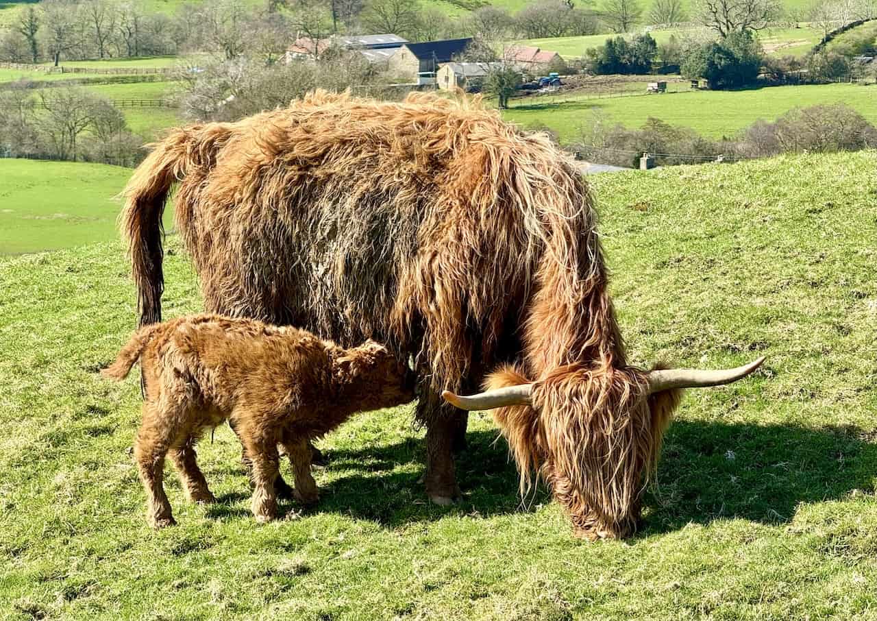
A scene of Highland cattle, featuring a cow and her calf, is captured. The mature Highland cow, distinguished by its long, wavy, reddish-brown fur, stands while the calf, seemingly newborn, enjoys the sunlight on a bright and clear day.
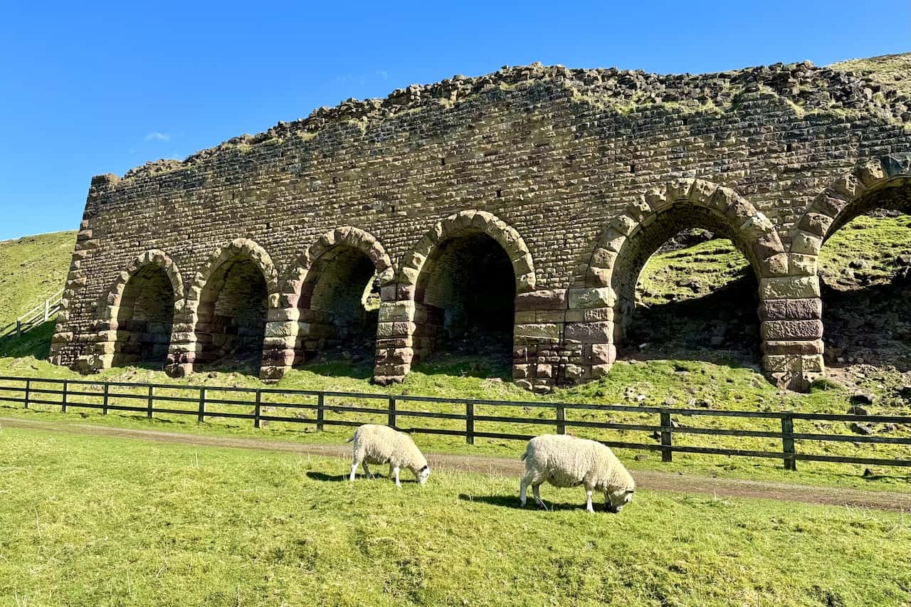
The Stone Kilns, similar in purpose to the Iron Kilns, were utilised to process the ironstone. Known as ‘calcining’, this roasting process began around 1863 for Rosedale’s East Mines. Before being transported to blast furnaces, ironstone was roasted in these substantial kilns to remove impurities, enrich the iron content, and break down large lumps into a smeltable size. This procedure, which also involved discarding waste, was instrumental in reducing transportation costs.
ADVERTISEMENT
The journey continues towards Thorgill, after joining Daleside Road from Low Thorgill Farm.
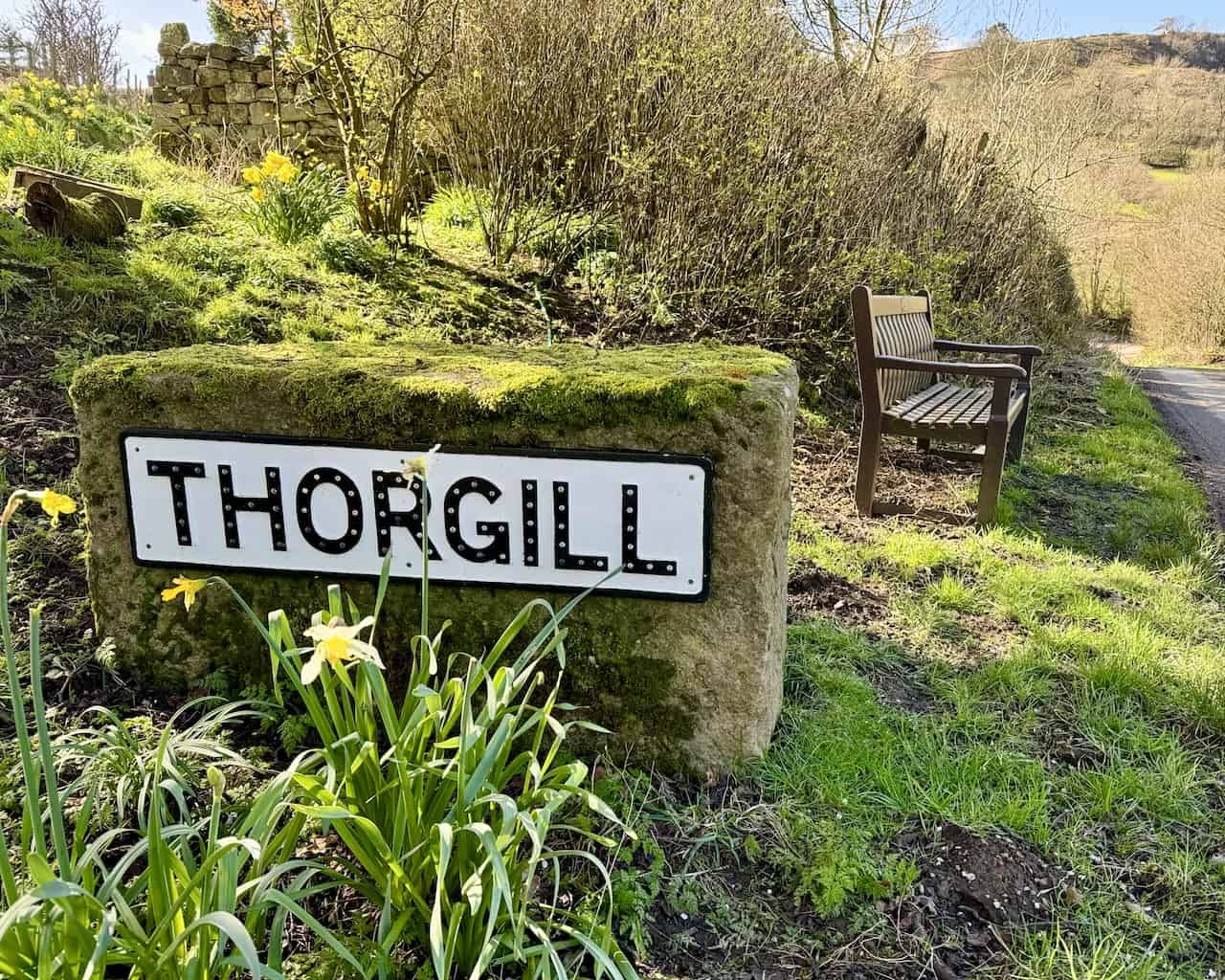
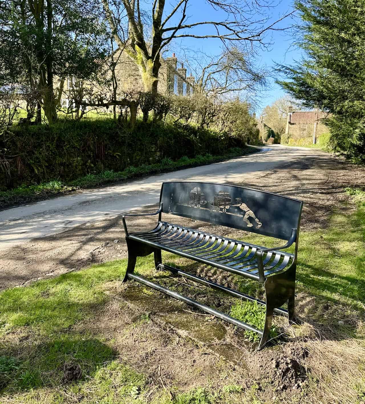
In Thorgill, an artistic iron bench depicts a worker pushing railway carts laden with ironstone, blending historical significance with local craftsmanship.
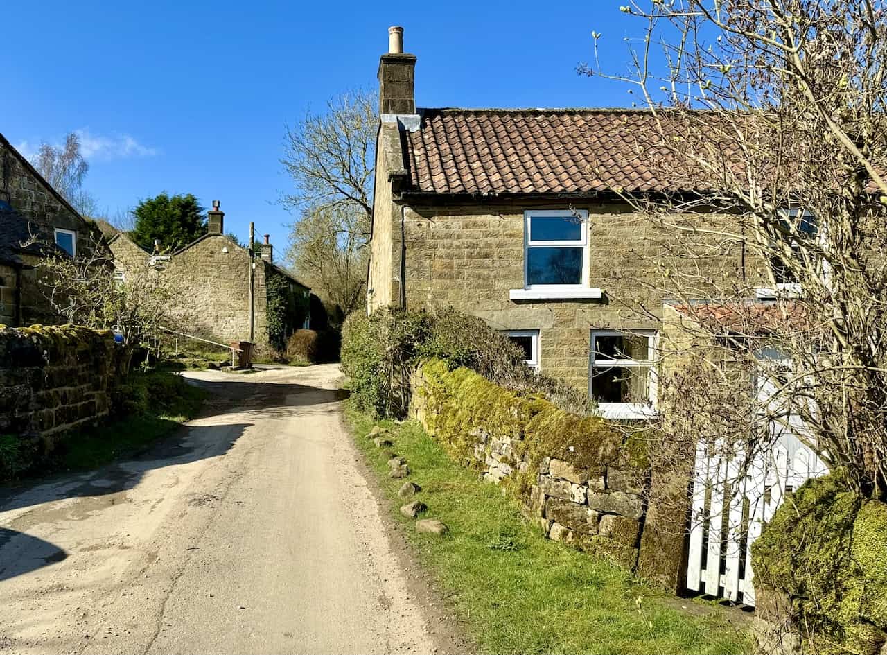
Walking through the hamlet of Thorgill presents a delightful experience, with plenty of spots to sit and enjoy sandwiches and refreshments in a pleasant setting.
ADVERTISEMENT
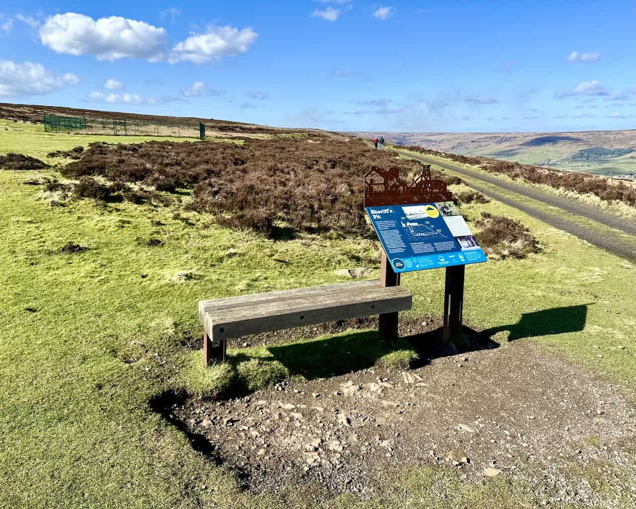
The climb out of the valley from Medd’s Farm leads to Sheriff’s Pit. Initially, Rosedale’s ironstone mines were drift mines, where a horizontal shaft was driven into the seam from the valley side, and ironstone was extracted via horse and cart. However, the advent of the Rosedale Railway necessitated the creation of a vertical shaft at this site, enabling mine tubs laden with ironstone to be directly hoisted from the drift mine. This mine bears the name of Alexander Clunes Sheriff, associated with the Rosedale Mining Company.
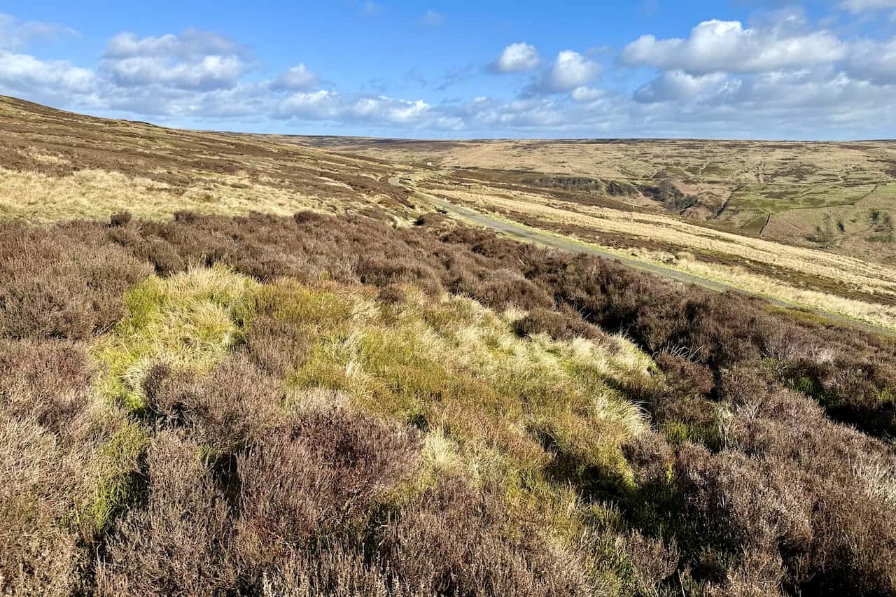
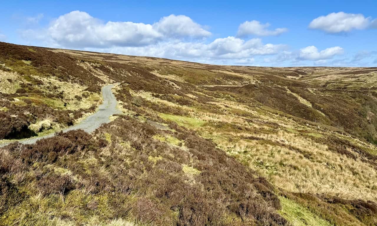
Travelling north on the dismantled railway above the western side of the Rosedale valley offers excellent views on a clear day, with the route being easily navigable.
The eastward view across the valley floor towards the section of the old railway line showcases the Iron Kilns (to the left) and the Stone Kilns (to the right) in the photograph’s upper third, illustrating the industrial heritage of the area.
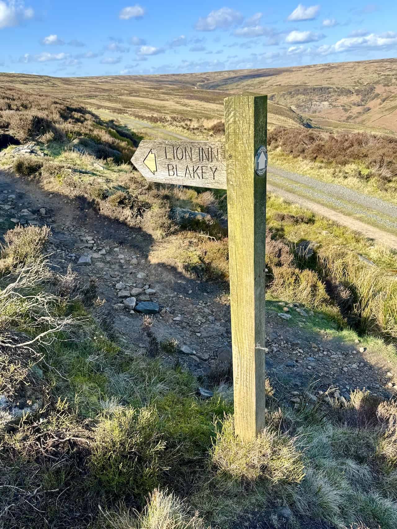
The Rosedale Railway walk concludes with a footpath leading off the trackbed of the old railway, signposted towards the Lion Inn Blakey, marking a memorable end to this scenic journey.
ADVERTISEMENT
ADVERTISEMENT