Explore the North York Moors on the Rievaulx Abbey Walk from Helmsley
Start your Rievaulx Abbey walk in Helmsley town centre, parking in the Cleveland Way Car Park, which is accessible from the B1257 main road on the town’s west side. Exit the car park via the main entrance near the toilets and turn left onto the Cleveland Way. Here, you’ll spot the prominent triangular-shaped stone statue marking the start of the Cleveland Way National Trail. Your walk will initially follow this trail as it heads west across open fields and alongside Blackdale Howl Wood.
As you enter the wood, descend some steps into a small valley, then ascend back up the other side. Continue along the well-defined track, and soon you’ll reach Griff Lodge. Pass to the left of the lodge and enter another woodland area. Follow the trail downhill until you reach a minor road, approximately three-quarters of a mile from the lodge. Turn left onto the road and walk down towards Rievaulx Bridge. At this point, you will leave the Cleveland Way National Trail.

Instead of crossing the bridge, turn right and follow the road north, signposted for the Rievaulx Abbey Ancient Monument. Continue along this road, and you’ll soon see the abbey on your right. Pass the abbey’s entrance and proceed into the village of Rievaulx. As you walk uphill, you’ll notice a picturesque thatched cottage on your left, followed by St Mary’s Church on your right. Opposite the church, take the track on your left, passing by the Rievaulx Methodist Chapel.
Continue along the track, avoiding the first left-hand fork, which leads through gates to a private residence. Instead, take the second left-hand fork downhill towards Bow Bridge. Cross the bridge and follow the track as it curves right into the woodlands. After walking for just over a mile from Bow Bridge, you’ll reach a junction near Tylas Farm. Here, the path offers several options: to the right, a track leads down to the farm, straight ahead is a path through gates, but your route is a sharp left uphill towards Tylas Barn. Continue past the farm buildings until you reach a minor road called Clavery Ley Lane. Turn right and head west into the village of Old Byland.
Walk through the village, and as the road bends to the right towards the village’s end, keep an eye out for the first public footpath on your left. Ignore this one and instead take the second public footpath on your left. This path leads you eastward along a narrow woodland path, eventually emerging into a large open area of farmland fields. Follow the path south along the field edges, which will guide you into Callister Wood. The path descends through the wood, crosses a footbridge, and leads to stepping stones across a small stream. Here, you will rejoin the Cleveland Way National Trail for the remainder of your Rievaulx Abbey walk.

From the stepping stones, head east along the well-defined stone track, passing several ponds on your left. The track reaches a minor road where you turn left. Follow the road past Hagg Hall, following signs for Helmsley and Rievaulx, to return to Rievaulx Bridge. After crossing the bridge, continue straight on. Soon, the road will bend left, but take the footpath on your right, which leads back into the woodlands you visited earlier. This woodland track ascends initially and will eventually bring you back to Griff Lodge. Pass by the lodge and take the path on the left marked as the Cleveland Way permissive path.
Re-enter Blackdale Howl Wood, descending into the small valley and climbing back up the steps again. Continue following the Cleveland Way all the way back to your starting point in Helmsley town centre. This delightful Rievaulx Abbey walk spans just over 11 miles, offering a scenic journey through the Rye Dale area of the North York Moors.
Rievaulx Abbey Walk: Maps and Tools
Visit either the OS Maps website or the Outdooractive website to view this walking route in greater detail. Both platforms offer a range of features, including the ability to print the route, download it to your device, and export the route as a GPX file. You can also watch a 3D fly-over and share the route on social media.
Rievaulx Abbey Walk: Distance, Duration, Statistics
Distance: 11½ miles
Distance: 18½ kilometres
Duration: 5½ hours
Ascent: 1400 feet
Ascent: 427 metres
Type: Circular walk

Recommended Ordnance Survey Map
The best map to use on this walk is the Ordnance Survey map of the North York Moors Western Area, reference OS Explorer OL26, scale 1:25,000. It clearly displays footpaths, rights of way, open access land and vegetation on the ground, making it ideal for walking, running and hiking. The map can be purchased from Amazon in either a standard, paper version or a weatherproof, laminated version, as shown below.
About Rievaulx
Rievaulx is a small village and civil parish nestled in Rye Dale. It lies within the North York Moors National Park, close to Helmsley in North Yorkshire, England. This quaint settlement is situated where the inner court of Rievaulx Abbey once stood, near the River Rye. According to the 2011 Census, the population of this civil parish was less than 100. The details are now included under the civil parish of Sproxton, North Yorkshire.
Historical Background
The history of Rievaulx is rich and varied. Originally, the inner court of the monastery housed key buildings like the brewhouse, bakehouse, and guesthouse. The village’s name comes from the River Rye and the Norman-French word ‘valle,’ meaning ‘valley.’ Locals initially pronounced it as ‘Rivers,’ but over time, it evolved into ‘Reevo’ due to the influence of French.
Aelred of Rievaulx, a notable figure, was an English Cistercian monk and abbot of Rievaulx from 1147 until his death in 1167. Both Anglicans and Roman Catholics regard him as a saint, and he rests in the abbey. Henry VIII dissolved the abbey in 1538 during the Dissolution of the Monasteries. Subsequently, the Earl of Rutland purchased the grounds and continued the iron-smelting industry that the monks had established. He set up a charcoal-fired blast furnace, which operated until the Civil War disrupted production in 1647.
The Transition to Agriculture
After the industrial activities ceased, Rievaulx transitioned into an agricultural village. Today, it remains a small settlement below the Abbey and the scenic Rievaulx Terrace & Temples. Builders constructed many of the village’s buildings using stones from the abbey ruins. For example, the old watermill, now a house, retains many original features, including the mill wheel. Additionally, the miller’s cottage still stands as a separate home. Notably, builders used materials from outside the abbey ruins for structures constructed after 1917, following conservation efforts.
Notable Structures on the Rievaulx Abbey Walk
One of the most significant buildings in Rievaulx is the Church of St Mary the Virgin, a Grade II listed building. Architect Temple Moore converted it in 1906. This structure originally served as the abbey’s slipper chapel, where pilgrims would remove their shoes before entering the sacred site.
In more recent times, Rievaulx has gained a unique connection to British politics. Former Prime Minister Harold Wilson took the title Baron Wilson of Rievaulx when he was raised to the House of Lords in 1983. Interestingly, he chose to pronounce it as ‘Rivers.’
Governance and Demographics
Historically, Rievaulx was part of the wapentake of Ryedale and the ecclesiastical parish of Helmsley in the North Riding. Later, it fell under the Helmsley Rural District before being integrated into the North Riding of Yorkshire in 1974. Although it maintains its own civil parish status, officials combined the 2011 population data with those of Sproxton Parish. According to a 2015 estimate by North Yorkshire County Council, Rievaulx’s population was around 90. The village is currently part of the Thirsk and Malton constituency for parliamentary representation.
Rievaulx Abbey Walk: My Photos
This stone statue stands near the entrance of the Cleveland Way Car Park in Helmsley town centre. It marks the beginning of the Cleveland Way National Trail, which stretches 109 miles (175 kilometres) to Filey. The statue is engraved with the names and distances of key locations along the trail, starting from Helmsley. Our Rievaulx Abbey walk heads in the same direction, following the track depicted in the photo.

From the stone statue in Helmsley, the path initially heads west across the countryside towards Blackdale Howl Wood. The route is easy to follow, with a smooth, navigable surface. It passes a majestic oak tree on the right-hand side.

In Blackdale Howl Wood, a tree stump marks the top of steps leading down into a small valley. Although the descent is not difficult, the area can become muddy in wet weather.

As the saying goes, ‘what goes down must come back up’. Here are the steps leading out of the valley.

After ascending the steps and leaving Blackdale Howl Wood, our Rievaulx Abbey walk takes us to Griff Lodge. The path splits here, and we take the left-hand route past the building.

This photo captures the view looking south from the path in front of Griff Lodge at the top of Jinny York Bank.

Continuing from Griff Lodge, our route heads west along the northern edge of Whinny Bank Wood. Up to this point, our Rievaulx Abbey walk follows the Cleveland Way National Trail.

Without a noticeable change in direction, the trail bends north-west and descends through Quarry Bank Wood. The path remains well-defined and easy to walk on.

At the bottom of the trail, we exit Quarry Bank Wood and meet a minor road, turning left and heading downhill.

Initially, a footpath runs along the left-hand side of the road. However, we soon have to walk on the road itself towards Rievaulx Bridge. The road is generally quiet, with few cars passing by.

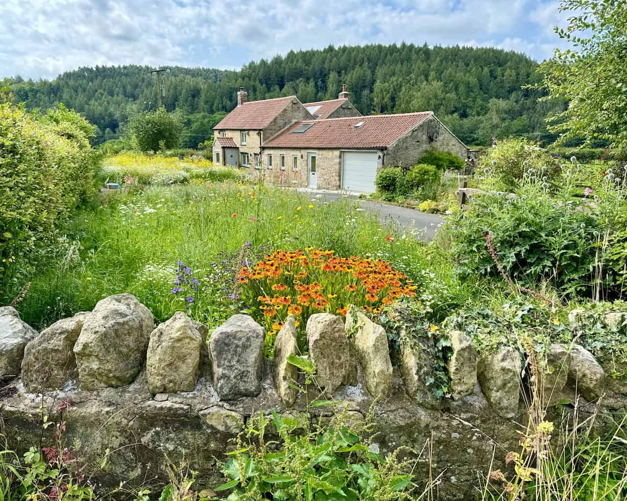
As we approach the bridge, we pass a charming house on our left-hand side.
We reach Rievaulx Bridge but do not cross it. Instead, we turn right, following a signpost for the Rievaulx Abbey Ancient Monument.

Shortly after turning towards the abbey, there is a lovely spot by the side of the bridge, perfect for a break or a snack. We will return to this bridge later in our walk, crossing it from the other side.
From Rievaulx Bridge, we follow the road north into Rievaulx. The road runs parallel to the River Rye, which flows to our left.

As we walk along the road, Rievaulx Abbey comes into view on our right-hand side.

Rievaulx Abbey looks stunning from this vantage point.

Continuing north along the road, we pass the entrance to the abbey visitor centre, with more splendid views of the abbey to our right.

Further along, we enter the village of Rievaulx, where we see a lovely traditional English cottage with a thatched roof on the left. This picturesque scene could easily adorn tea towels, mugs, postcards, calendars, jigsaw puzzles, greeting cards, or canvas prints.

At the northern end of the village, near the top of the road, stands St Mary’s Church, a Grade II listed building. This church once served as the slipper chapel for Rievaulx Abbey, where pilgrims would remove their footwear before completing their pilgrimage. Architect Temple Moore adapted the church in 1906, making it a significant historical and architectural site.

Almost opposite the church, our Rievaulx Abbey walk continues by turning left off the road and heading north-west up a smaller track past a chapel.

The beautiful chapel we pass is known as Rievaulx Methodist Chapel.

From the chapel, our track ascends towards Air Bank Wood. Shortly, we encounter a fork and take the right-hand track uphill, avoiding the left-hand track leading downhill through gates to a private residence.

Soon after, in Air Bank Wood, another fork appears. This time, we take the left-hand track heading downhill towards Bow Bridge.
Our Rievaulx Abbey walk takes us across Bow Bridge, which spans the River Rye.

After crossing Bow Bridge, we follow the stone track that veers right into the woodland. Our route continues uphill through Lambert Hag Wood and then past the right side of Far Hag Wood.

As we proceed along the track, we enjoy stunning views to the north, looking down into the valley known as Rye Dale.

Here, careful navigation is required. At a crossroads, turning right would lead us downhill to Tylas Farm, continuing straight would take us across fields to Birk Bank, but we make a sharp left uphill towards Tylas Barn.

This photo shows Tylas Barn, with our route continuing past the left-hand side of the farm buildings, heading west.

After crossing fields and farmland, we reach Clavery Ley Lane, a minor road leading into the village of Old Byland. The road runs from north to south through the village. It’s a lovely spot for lunch, and we found a handy bench after searching around.

All Saints Church in Old Byland is a historic Grade I listed building with origins in the late Saxon period. The church features Norman architecture, with the chancel and nave walls reflecting its Saxon construction. The nave and porch tower were reconstructed in the late 11th to early 12th centuries, following the Norman Conquest. Notable Norman carvings include human heads with ram’s horns and winged horses. The church also features a Saxon arch over a blocked priest’s door and an ancient sundial embedded in the porch wall. Over the centuries, All Saints Church has undergone various modifications, including significant restorations in the 14th or 15th centuries. These added new windows and a tiled sanctuary floor. Inside, you can find a Norman tub font and medieval floor tiles arranged in a circular pattern. Despite historical upheavals, the church has remained a spiritual centre for the community, hosting regular services.

As we leave, this view captures the village’s southern end looking back towards the north. Large stone houses with sizeable lawned gardens line one side of the road, while a large rectangular village green, surrounded by cottages, occupies the other side. The village exudes a peaceful charm.

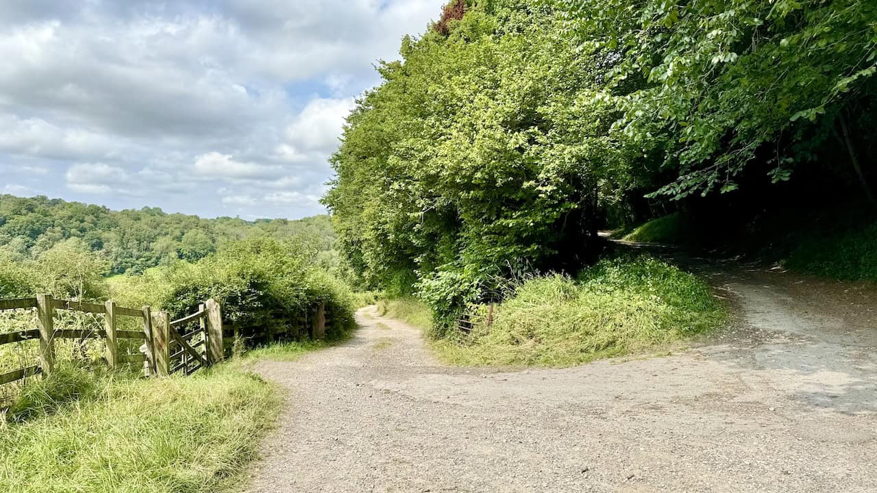
After leaving Old Byland via Hill Gill, we follow the countryside path south along the edge of several fields, eventually reaching Callister Wood.

A delightful section of our Rievaulx Abbey walk features stepping stones across a small stream shortly after emerging from Callister Wood.

There are four stepping stones, shaped like arrowheads pointing upstream. This design helps direct the water flow around them.
At the location of the stepping stones, our Rievaulx Abbey walk rejoins the Cleveland Way National Trail back to Helmsley. We will remain on this trail for the rest of our walk.

Our walk continues east through Nettle Dale, passing four ponds on our left.

The path through Nettle Dale is well-maintained, smooth, and easy to walk on.

As we walk along the road, we approach Hagg Hall, which is actually a farm.

Just after Hagg Hall, we reach a crossroads. We continue along the quiet road, signposted Helmsley and Rievaulx.
Eventually, we return to Rievaulx Bridge, where we were earlier. The bridge crosses the River Rye, a short river of about 20 miles (32 kilometres) originating on Snilesworth Moor and flowing into the River Derwent near Malton.

Now on familiar ground, we head back to Helmsley along the Cleveland Way, enjoying the pleasant countryside. Our Rievaulx Abbey walk has been truly delightful.

We pass Griff Lodge once again.

Back in Blackdale Howl Wood, it’s time to navigate the steps down into the small valley and then back up again.

Our walk is almost complete as we head east on the final stretch of the Cleveland Way into Helmsley. We enjoy a great view of Helmsley Castle on our right.

We conclude our Rievaulx Abbey walk at the Cleveland Way stone statue. The names of places like Sutton Bank, Osmotherley, Cleveland Hills, Kildale, Roseberry Topping, Saltburn, Staithes, Whitby, Robin Hood’s Bay, Ravenscar, Scarborough, and Filey are engraved on the statue.

Highly Rated Osprey Hiking Backpacks for Outdoor Enthusiasts
Osprey’s reputation for crafting high-quality hiking backpacks is well-established, offering a range of options that cater to both men and women. The following four backpacks stand out for their excellent sales and customer ratings on Amazon, making them a top choice for outdoor enthusiasts seeking reliability and comfort. As an Amazon affiliate, I may earn a small commission from any purchases made through the links provided. This helps support the upkeep of this website. Rest assured, you won’t pay a penny extra, but your purchase will contribute to keeping my site running smoothly. Happy walking!

Osprey Tempest 20 Women’s Hiking Backpack
The Tempest 20 stands out as the ideal solution for day-hiking, biking, or peak-bagging, tailored specifically for women. It features a panel-loading design for ease of access, complemented by an internal zippered mesh pocket with a key clip for secure storage. Unique to this model are the Stow-on-the-Go trekking pole and LidLock bike helmet attachments, enhancing its versatility. Side stretch mesh pockets, along with an easy-access, expandable stretch mesh harness pocket, offer ample storage. Additionally, it includes a blinker light attachment (light not included) and a large stretch mesh front panel pocket for extra carrying capacity.

Osprey Talon 22 Men’s Hiking Backpack
Designed for the active adventurer, the Talon 22 provides an optimal panel-loading design suitable for day-hiking, biking, or peak-bagging. Key features include dual-zippered panel access to the main compartment and a tuck-away ice ax attachment with a bungee tie-off. It boasts a top panel zippered slash pocket for quick access items and lower side compression straps for load management. An external hydration reservoir sleeve and dual-zippered fabric hipbelt pockets enhance hydration and storage, while a large stretch mesh front panel pocket increases its utility for various activities.

Osprey Tempest 30 Women’s Hiking Backpack
The Tempest 30, designed with a women’s-specific fit, is a streamlined top-loader ideal for both extensive day trips and light-and-fast overnight adventures. It includes a fixed top lid with an external zippered slash pocket and an under-lid zippered mesh pocket with a key clip for organised storage. The pack features a tuck-away ice ax attachment with a bungee tie-off, dual upper and lower side compression straps for load adjustment, and an external hydration reservoir sleeve. For added convenience, it offers an easy-access, expandable stretch mesh harness pocket and dual-zippered fabric hip-belt pockets.

Osprey Talon 33 Men’s Hiking Backpack
The Talon 33 is engineered for dynamic movement, making it the perfect streamlined top-loader for committed day trips or light-and-fast overnight excursions. It features top load access to the main compartment for easy packing and retrieval. The backpack is equipped with a large stretch mesh front panel pocket, Stow-on-the-Go trekking pole attachment, and stretch mesh side pockets for versatile storage options. Additionally, an easy-access, expandable stretch mesh harness pocket and dual-zippered fabric hip-belt pockets offer convenient storage solutions for essential gear.